
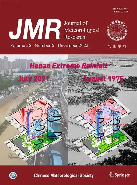
Record Flood-Producing Rainstorms of July 2021 and August 1975 in Henan of China:Comparative Synoptic Analysis Using ERA5
2023-01-16 12:05JianRAOJinXIEYongCAOSuxingZHUandQianLU110044100081310044
Jian RAO, Jin XIE, Yong CAO, Suxing ZHU, and Qian LU1 ,,10044 ,,1000813 ,,10044
ABSTRACT This study compares two rainstorms that swept through Henan Province of China in July 2021 and August 1975.The heavy rainfall and related synoptic systems and processes are diagnosed based on hourly ERA5 reanalysis data and precipitation observations from the China Meteorological Administration. It is estimated that most of the daily rainfall in Henan was caused by synoptic-scale precipitation, with the sub-synoptic convective rainfall intermittently dominating some of the hourly total rainfall. The rainband moved at about 2 m s?1 during the July 2021 rainstorm,whereas it was almost stationary during the August 1975 rainstorm when the heavy rainfall was concentrated in southern Henan. A double-typhoon circulation pattern with a subtropical high over the Bohai and Yellow Seas was observed during both rainstorms. The heavy rainfall during the July 2021 event was controlled remotely by Typhoons Cempaka and In-Fa, which provided a path for the transport of moisture via the southerly jet associated with Typhoon Cempaka and the easterly (or southeasterly) jet associated with Typhoon In-Fa. The rainstorm in August 1975 was caused more directly by Typhoon Nina, which made landfall in Fujian Province and moved toward Henan Province. The rainfall around the inverted trough of the motionless Typhoon Nina produced a cumulative effect. The two rainstorms also differed in their circulation patterns in the upper troposphere. The intrusion of high potential vorticity air over Central China occurred in the July 2021 extreme rainstorm, whereas the South Asian high was enhanced and biased further north during the August 1975 rainstorm. Further analysis showed that the northward and westward transport of moisture took place during the July 2021 rainstorm, whereas the westward transport of moisture from the east of Henan dominated near the inverted trough of Typhoon Nina during the August 1975 rainstorm.
Key words: August 1975 (“75.8”) rainstorm, July 2021 (“21.7”) rainstorm, Henan rainstorms, double-typhoon circulation patterns
1. Introduction
Extreme rainfall can cause large amounts of damage to human societies, ecosystems, and the natural environment, leading to heavy economic losses and high death tolls (Huang, 1999; Easterling et al., 2000). Excessive amounts of rain and frequent heavy rain events during the rainy season can lead to rising water levels in rivers,lakes, and reservoirs (Qian et al., 2013). Extreme precipitation events that cause severe floods, such as the 2010 summer flood in Pakistan and the 1998 summer flood in China, are usually regional phenomena (Zou and Ren,2015). Heavy rain is projected to increase in Europe(Christensen and Christensen, 2003), southern central USA (Wang and Zhang, 2008), Arctic (Saha et al.,2006), and some parts of China (Zhang et al., 2006; Feng et al., 2007) as a result of the global climate crisis. By contrast, heavy rainfall events might decrease in regions such as Central Australia (Taminiau and Haarsma, 2007)and the Canadian prairies (Wang and Zhang, 2008). Surplus precipitation and the subsequent floods have catastrophic consequences for both people and property and endanger sustainable development goals (Gao et al.,2017).
Heavy rainfall over South China has different properties in the early and late rainy seasons. Heavy rain in the early rainy season is closely related to the timing of the onset of the monsoon in the South China Sea and sea surface temperatures in the tropical Pacific and Indian oceans (Ding, 1994; Gu et al., 2018; Yuan et al., 2019).Heavy rainfall during this period often occurs near the stationary South China front or in the warm sector (Luo et al., 2017; Chen and Luo, 2018; Du and Chen, 2018).The influencing systems in the late rainy season are mainly monsoonal troughs and lows (Huang et al., 2005;Jiang et al., 2007; Meng et al., 2014), in addition to tropical cyclones (Meng and Wang, 2016). One of regions most susceptible to extreme precipitation events is the mid–lower reaches of the Yangtze River in China (Zou and Ren, 2015). Heavy rain near the Meiyu–Baiu front is mainly related to mesoscale disturbances and mesoscale convective systems moving forward along the front(Ding, 1993; Sun et al., 2010). The factors affecting heavy rainfall over the Yangtze–Huai River valley include the mid-tropospheric jet, the southerly low-level jet(Sampe and Xie, 2010), the mesoscale vortex (Fu et al., 2015, 2016) and the long-lived vortex along the front (Fu et al., 2013).
Strong convective rainfall can also occur in North China and may be enhanced by the south–north-oriented Taihang Mountains and the west–east-oriented Yan Mountains (Zhang and Zhai, 2011; Chen et al., 2013;Luo et al., 2016; Xia and Zhang, 2019). Although far from the coasts and oceans, rainstorms also occur in Central China when the southwest vortex and related low-level southwesterly jet move eastward, bringing adequate moisture from the Bay of Bengal (Wang and Liu,2017). As one of the most densely populated provinces in China, Henan has experienced several severe historical heavy rainstorms in summer. An unprecedented heavy rainstorm occurred in Henan from 5 to 7 August 1975,which was caused by a typhoon that intruded northward after making landfall (Ding, 2015). Extreme rainfall from Typhoon Nina led to catastrophic flooding, resulting in 26,000 fatalities, and left about 10 million people without adequate shelter (Ding, 2015; Yang et al., 2017). Famine and disease after the flooding caused about 100,000 additional fatalities (Hu and Luo, 1992). Another heavy and persistent rainstorm struck Henan from 19 to 22 July 2021, causing a sudden rise in the water levels of rivers and severe inundation of inland urban areas, resulting in tens of fatalities in Zhengzhou, the provincial capital of Henan. The differences and similarities in the synoptic circulation patterns between these two remarkable rainstorms in Henan have not yet been explored in detail.
This study explores the evolution of the background circulation from the perspective of synoptic analysis during two rainstorms in Henan in August 1975 and July 2021. Further, the synoptic systems of the two rainstorms are compared. The organization of the paper is as follows. Section 2 introduces the data and methods. Section 3 presents the distribution of rainfall and the evolution of the rain rate during the two rainstorms. Section 4 presents the synoptic analysis of the two rainstorms. The summary and discussion are given in Section 5.
2. Data and methods
2.1 Reanalysis and observational datasets
The ECMWF fifth-generation hourly reanalysis dataset (ERA5; Hersbach et al., 2020) is used to analyze the atmospheric circulation during the rainstorms. The ERA5 dataset has an equivalent native grid of 0.25° latitude ×0.25° longitude, and we downloaded the dataset at this resolution. The geopotential (divided by 9.8 to obtain the geopotential height), Ertel’s potential vorticity, zonal winds, meridional winds, and temperatures are available from the ERA5 dataset at 37 pressure levels from 1950 to the present day. We also used single-level hourly variables, including the total rainfall, large-scale (mainly synoptic-scale) rain rate, and convective rain rate. We used this reanalysis dataset because it covers both the August 1975 and July 2021 rainstorms in Henan. In addition, the horizontal and temporal resolutions are sufficiently fine to reveal the evolution of the local circulation in Central China during heavy rainstorms.
We used observational rainfall data from meteorological stations compiled by the National Meteorological Information Centre of the China Meteorological Administration in July 2021 to validate the ERA5 rainfall data.The precipitation in the ERA5 grids might miss the center of maximum observed rainfall associated with the topography as a result of the effect of mesoscale systems on rainfall.
2.2 Methods
The hourly total precipitation in the ERA5 dataset consists of convective rainfall and synoptic-scale rainfall.The convective rain rate and synoptic-scale rain rate are both available in this dataset. Assuming that the hourly rain rate is constant, the hourly convective rainfall and the synoptic-scale rainfall were assessed by integrating the rain rate by the total time (i.e., 3600 s). We assumed that the sum of the hourly convective rainfall and synoptic-scale rainfall was equal to the total hourly rainfall. We can evaluate the contribution of the large-scale cloud scheme and convection scheme to heavy rainfall events.The synoptic-scale rainfall in the ERA5 dataset is generated by the cloud scheme (clouds with a diameter > 25 km can be resolved in this system), whereas the convective rainfall is produced from the sub-grid convection scheme. Deficiencies in the sub-grid convection parameterization schemes considering smaller scale (i.e., < 25 km) unresolved convection systems might lead to large biases in the heavy rain rate.
To evaluate the contribution of topography to vertical motion, we parameterized the vertical motion caused by steep mountains in the boundary layer aswtopo=V0·?Z0(Saltzman and Irsch, 1972), wherewtopois the topography-forced vertical motion,V0is the horizontal winds in the boundary layer (the boundary top is usually 1–1.5-km high relative to the surface), assessed by the winds from 1000 to 850 hPa, andZ0is the elevation. This approximation shows that steep mountains, strong winds,and large angles between the orientation of the mountains and the winds (or a small angle between the topographic gradient and the winds) usually produce strong vertical motion in the boundary layer. Considering that the vertical velocity from the ERA5 dataset is saved in the pressure coordinate, we converted the topographyforced vertical motion from thez-coordinate to the pressure coordinate as ωtopo≈?ρ0gw0=?ρ0gV0·?Z0, where ρ0andgare the air density and gravitational acceleration,respectively. Because the estimated topography-forced vertical motion showed a similar pattern using the winds at 950, 925, or 850 hPa, only the results at 850 hPa are shown.
3. Evolution of the two rainstorms
3.1 Comparison of the distribution of rainfall
Figure 1 shows the day-by-day variations in the daily cumulative rainfall for the July 2021 and August 1975 rainstorms in Henan, with terrain heights > 500 m. We used the universal time coordinate (UTC). Heavy rain swept through Henan from 19 to 22 July 2021, with the center of the highest daily rainfall near the provincial capital of Zhengzhou. The rain began in the south on 19 July and then moved northward (Fig. 1a). The center of rainfall (> 100 mm) reached Zhengzhou on 20 July, but was hindered by the higher topography in the north and west (Figs. 1b, c). A band of heavy rain (> 250 mm)formed along the edge of the mountains from 20 to 21 July, highlighting the important role of the steep topography. The heavy rain ended as the rain band gradually decreased in size from 22 July (Fig. 1d).

Fig. 1. Evolutions of the daily accumulated precipitation (P; mm) for the two rainstorms in Henan, China (a–d) from 19 to 22 July 2021 in the ERA5 reanalysis dataset for the most recent super rainstorm and (e–h) from 5 to 8 August 1975 in the ERA5 reanalysis dataset for an historical flood resulting from continuous rainfall. The red dots mark Zhengzhou, and the black dots mark Zhumadian meteorological station. The dark and light gray shadings show terrain above 1000 and 500 m, respectively.
The rainfall center was further to the south during the August 1975 rainstorm (Figs. 1e–h). The heavy rain initialized before 5 August and the maximum daily rainfall(> 100 mm) was centered in the south of Henan (Fig. 1e).The rainstorm was intense at the very beginning and moved north to Henan on 6 August, with the center of maximum daily rainfall (> 200 mm) to the west of Zhumadian (Fig. 1f), where river dams were damaged, the floods destroyed properties, and led to the loss of lives.The heavy rain continued and accumulated by > 300 mm on 7 August (Fig. 1g), further enhancing flooding in Henan, leading to a huge death toll, and leaving millions of people homeless. It was estimated that flooding resulted in 26,000 fatalities and left about 10 million people without adequate shelter (Ding, 2015; Yang et al., 2017).Post-flood famine and disease added another 100,000 fatalities (Hu and Luo, 1992). The rain did not end until 8 August (Fig. 1h) and it took even longer time for the floods to retreat.
3.2 Contributions from convective- and synoptic-scale rainfall
Figure 2 shows the evolutions of the hourly total rain rate and the contributions from convective-scale and large-scale precipitation schemes for Zhengzhou and Zhumadian. For the July 2021 rainstorm, the rainfall center was around Zhengzhou and the hourly rain rate was much larger in Zhengzhou than in Zhumadian at most times during 17–22 July. Synoptic-scale precipitation contributed about 80% of the total rainfall from 20 to 21 July in Zhengzhou (Fig. 2a), whereas convective precipitation dominated in the initiation and decaying phases of this event, accounting for about 90% of the total rainfall.By contrast, convective precipitation dominated the total rainfall during the entire event around Zhumadian. The short-duration precipitation at 0800 UTC 20 July 2021 was also related to the rapid development of convection(Fig. 2b).
Similar characteristics were also seen in the August 1975 rainstorm in Zhengzhou. During the developing and mature phases of this persistent rainfall event (6–8 August), synoptic-scale precipitation explained most the total rainfall (80%–90%) in Zhengzhou. By contrast,convective precipitation was more active in the initial and decaying periods of this rainstorm (Fig. 2c). The rainfall period was relatively short, but fairly intense, in Zhumadian and convective and synoptic-scale precipitation led alternately to several peaks around 0600 UTC 6,0000 UTC 7, and 0600 UTC 7 August, respectively.
Figure 3 shows the latitude–time cross-sections of the hourly mean rain rate along 114°E for the two rainstorms. The rainband in the July 2021 rainstorm initialized around 32°N and the center of rainfall then moved gradually northward from 0000 UTC 19 to 0000 UTC 22 July at a speed of about 2 m s?1, that is, it moved 5° of latitude (about 550 km) from 32° to 37°N in 3 days. The gradual movement of the center of the rainband allowed time to pre-warn the population in Zhengzhou, which helped to avoid unnecessary loss of life and livelihoods.An assessment of the entire process of this rainstorm shows that convective precipitation accounted for only a very small part of the total rainfall (10%–20%; Fig. 3b)and that synoptic-scale precipitation associated with mesoscale and synoptic systems dominated (Fig. 3c). The centers of total rainfall were consistent with the centers of synoptic-scale precipitation. The northward movement of the synoptic-scale precipitation was identical to the movement of the total rainfall.

Fig. 2. Hourly evolutions of precipitation extracted from the ERA5 dataset for (a, c) Zhengzhou and (b, d) Zhumadian during the two rainstorms. The total rain rate is shown as black lines, whereas the convective rain rate and the synoptic-scale rain rate are shown as dark gray and light gray lines, respectively. In the legends, tp: total precipitation; crr: convective rain rate; and ssrr: synoptic-scale rain rate.

Fig. 3. Latitude–time cross-sections of the hourly accumulated rainfall along 114°E during (a–c) 18–22 July 2021 and (d–f) 5–8 August 1975.
There were some differences between the two rainstorms. For the August 1975 rainstorm, the rainfall initialized further south before 5 August (about 30°N; Fig.3d). The rainfall center gradually moved northward and was centered around 33°N from 1200 UTC 6–8 August.Similar to the July 2021 rainstorm, convective precipitation accounted for only a very small part (10%–20%;Fig. 3e) of the total rainfall and most of the rainfall was contributed by synoptic-scale precipitation (Fig. 3f). The precipitation around 34°–36°N at 1200 UTC 5 August was related to local convection (Figs. 3d vs 3e). The movement in the initial stage and when stationary in the developing and mature stages was controlled by synoptic-scale precipitation associated with the resolved mesoscale and synoptic systems (Fig. 3f).
3.3 Validation of the ERA5 precipitation data with station observations
To further confirm the reliability of the evolution of the rainfall event in the ERA5 dataset, Fig. 4 shows the station rainfall for the July 2021 rainstorm; hourly observations were unavailable for the August 1975 rainstorm.The distribution patterns of rainfall during the July 2021 rainstorm were fairly similar between ERA5 data and the station observations (Figs. 4a–d vs 1a–d). For example,both datasets show that the center of maximum rainfall on 19 July was in central Henan, before moving to Zhengzhou on 20 July and producing > 300-mm precipitation in a day (Figs. 4a, b). The rainfall center moved further north along the edge of the mountains on 21 July 2021 (Fig. 4c). The continuous rainfall ended in Henan on 22 July 2021 when the center decayed and moved further north (Fig. 4d). Although the pattern of heavy rainfall is well described by the ERA5 dataset, we can identify some differences between the real-time observations and the ERA5 data. We found that the daily rainfall intensity was largely underestimated during the developing and mature stages of the rainstorm. The maximum hourly precipitation in Zhengzhou was about 8 mm in the ERA5 dataset (at 0400 UTC 20 July 2021), but the maximum hourly precipitation exceeded 200 mm in the station observations (at 0900 UTC 20 July 2021). This underestimation might be because the model grid is not located in the cities and/or that the smaller scale processes between neighboring grids are lost in the ERA5 system.

Fig. 4. (a–d) Evolutions of the station observations of daily accumulated precipitation (mm) for the July 2021 rainstorm in Henan, China used to validate the ERA5 rainfall data. The dark and light gray shadings show terrain above 1000 and 500 m, respectively. (e) Hourly evolution of the total rain rate in Zhengzhou and Zhumadian from 17 to 22 July 2021 from the station observations used to validate the ERA5 rainfall data.
Figure 4e shows the hourly precipitation from 17 to 22 July 2021 for Zhengzhou and Zhumadian. The observations show strong pulses of rainfall soon after the rain began. The time series has been smoothed by using a window of 13 h to remove high-frequency processes.Despite this smoothing, the maximum hourly rainfall in Zhengzhou still reached > 200 mm at about 0800 UTC 20 July, submerging the city and leading to serious traffic confusion. Consistent with the ERA5 dataset, most of the rain was produced during 19–21 July. The observed maximum hourly rain rate in Zhengzhou was much larger than the corresponding value from the ERA5 dataset(about 7 mm; Figs. 2a, b vs Fig. 4e). The maximum peak of the hourly rainfall in Zhengzhou was several hours earlier in the ERA5 dataset than in the observations. By contrast, the sudden rainfall pulse around 1000 UTC 20 July near Zhumadian was almost identical in the two datasets (about 20 mm).

Fig. 5. Synoptic charts of the geopotential height (shadings; gpm) and streamlines at 850 hPa for (a–d) the July 2021 rainstorm and (e–h) the August 1975 rainstorm. Only the meteorological fields at 0000 UTC are shown. The brown lines show the inverted troughs of the tropical cyclones. Regions with topography > 1500 m are shown in gray.
4. Analysis of the synoptic systems and associated rainfall processes
4.1 Role of tropical cyclones
Figure 5 shows the synoptic charts of the geopotential heights and horizonal winds at 850 hPa for the two rainstorms. Previous studies have indicated that extreme rainfall and flooding for the August 1975 rainstorm were associated with Super Typhoon Nina (Ding, 2015; Yang et al., 2017). We compared the possible role of tropical cyclones in the formation of heavy rainfall in Henan for the two rainstorms. Typhoon In-Fa formed in Northwest Pacific and Tropical Cyclone Cempaka appeared in the South China Sea before the July 2021 rainstorm (Figs.5a–d). Typhoon In-Fa did not make landfall and remained in Northwest Pacific. The easterly winds north of the typhoon bridged the East China Sea and Central China and carried abundant moisture. Typhoon Cempaka was weaker than Typhoon In-Fa. The southerly winds east of Typhoon Cempaka were seen far to the north, especially on 19 and 20 July, and transported abundant moisture north from the South China Sea.Typhoon In-Fa was prevented from moving east and north by the stable subtropical high over the Bohai and Yellow Seas.
Some similarities were found for the August 1975 rainstorm. The subtropical high over the Bohai and Yellow Seas was stable on 5–6 August (Figs. 5e, f). Moisture was carried from the oceans by southwesterly and southeasterly winds. However, Typhoon Nina then moved inland during a 3-day period from 5 to 7 August 1975. Early studies emphasized that Typhoon Nina developed from a tropical depression into a storm in the Philippine Sea on 31 July 1975 (Ding, 2015; Yang et al.,2017). During its northward movement, it experienced explosive development from 1 to 2 August and main landfall in Taiwan at 0600 UTC 3 August. After leaving Taiwan, it made landfall in Fujian Province and continued northwest before turning north on 5 August in Hubei Province (Fig. 5e). Typhoon Nina hit Henan on 6 August and remained stationary before decaying on 8 August (Fig. 5f–h). Similar to the July 2021 rainstorm, two typhoons coexisted during the August 1975 rainstorm. A short-lived unnamed tropical cyclone formed in Northwest Pacific from 5 to 6 August 1975. This tropical cyclone merged with the decaying Typhoon Nina, forming a huge cyclonic circulation in South China that transported warm, moist air inland from Northwest Pacific (Figs.5g, h).
4.2 Intrusion of high potential vorticity air into the upper troposphere
Figure 6 shows the synoptic charts of the potential vorticity at 200 hPa for the two rainstorms. For the July 2021 rainstorm, Rossby waves were broken in the upper troposphere (Bueh et al., 2022). Two high potential vorticity systems appeared over Northwest China and the Bohai Sea from 19 to 20 July (Figs. 6a, b), consistent with the development of cold vortices at 200 hPa (figure omitted). The movement of the high potential vorticity system suggests a supply of cold air from high latitudes in the upper troposphere. The high potential vorticity band moved to the neighboring provinces to the west on 21 July,continuing the strong static instability (Ran et al., 2021)(Fig. 6c). The high potential vorticity streamer strengthened the positive vorticity and stabilized the local vortex(the trough at 500 hPa), facilitating the low-level jet and therefore the transport of water vapor to Henan (Bueh et al., 2022). The cyclic wave finally broke on 22 July as the high potential vorticity cluster over the Bohai Sea moved eastward (Fig. 7d).

Fig. 6. Synoptic charts of the potential vorticity (PV) (shadings; PVU) at 200 hPa and geopotential height (contours) at 500 hPa for (a–d) the July 2021 rainstorm and (e–h) the August 1975 rainstorm. Only the meteorological fields at 0000 UTC are shown. The brown lines show the mesoscale troughs or the inverted troughs of the tropical cyclones at 500 hPa.
The high potential vorticity system was weaker during the August 1975 rainstorm (Figs. 6e–h) than during the July 2021 rainstorm. The high potential vorticity band appeared over Northwest and Central China, whereas large patches of negative potential vorticity controlled Central China. The negative potential vorticity indicates that the strong outflow at 200 hPa (omitted) associated with the landfalling typhoon was a prominent feature of the August 1975 rainstorm. Consistent with the upper tropospheric divergence, the anomalous high might have appeared as patches of negative potential vorticity, which propelled the South Asian high further north. The high potential vorticity streamer from higher latitudes moved toward Henan, but had not reached the province by 8 August 1975 (Figs. 6g, h). This high potential vorticity streamer and the associated trough, together with the downstream high over the Bohai and Yellow Seas,helped to anchor Typhoon Nina (Figs. 6e–h).
4.3 Comparison of vertical motion in the two rainstorms
Figure 7 shows the synoptic charts of the horizontal winds and the vertical velocity at 850 hPa for the two rainstorms. The persistent upwelling required for heavy rain was observed during both rainstorms, but the largest upwelling was centered at different positions. For the July 2021 heavy rainfall event, the upwelling center moved gradually north, together with a short-lived mesoscale cyclone (Figs. 7a–d). As the cyclone developed in the neighboring southern province of Hubei on 19 July,strong upwelling was initialized as the movement of the cyclone was hindered by the terrain in Henan (Fig. 7a).The mesoscale trough gradually moved northward from 20 to 21 July, accompanied by an enhancement of upward motion (Figs. 7b, c). This enhancement of the vertical velocity was probably associated with the lifting effect of the topography. The combined effect of the mesoscale trough and the topography led to extremely strong upwelling. The inverted trough eventually moved out of Henan on 22 July, consistent with the end of the heavy rainfall.
By contrast, the precipitation during the August 1975 rainstorm was mainly caused by the landfalling typhoon.The physical mechanisms of tropical cyclone rainstorms have attracted much attention from Chinese researchers(e.g., Ding, 2015). Typhoon In-Fa caused remote rainfall by transporting abundant water vapor into Henan during the July 2021 rainstorm. By contrast, the heavy rain during the August 1975 rainstorm was more directly related to the spiral rainband and the inner rainband of Typhoon Nina, that is, the largest upwelling occurred around the inverted trough and near the inner part of the typhoon(Figs. 7e–h). The strong upward motion was further enhanced by the easterly winds and the topography, leading to heavy rainfall and the release of latent heat, which fed back into the typhoon from 5 August (Fig. 7e). The unusually persistent typhoon, which lasted for 3 days(Figs. 7e–g), decayed very slowly until the cyclonic center dissipated (Fig. 8h), probably as a result of the large amount of friction caused by the surface.
Figure 8 shows the evolution of the vertical velocity for Zhengzhou and Zhumadian during the two rainstorms to assess the forced effect of the topography on the vertical motion. Some differences were observed between the two stations. The upward motion forced by the topography explained most of the vertical velocity in the regions encircled by mountains, such as Zhengzhou(Figs. 8a, c). For the July 2021 rainstorm, nearly half of the vertical velocity from 20 to 21 July was caused by the steep terrain in Zhengzhou (Fig. 8a). For the August 1975 rainstorm, nearly all of the vertical velocity was forced by the topography (Fig. 8b). The effect of topography might be overestimated by the empirical formulas because typhoons can produce strong upwelling around the cloud walls, even without topographic forcing.

Fig. 7. Synoptic charts of the horizonal winds (vectors; m s?1) and vertical velocity (shadings; Pa s?1) at 850 hPa for (a–d) the July 2021 rainstorm and (e–h) the August 1975 rainstorm. Only the meteorological fields at 0000 UTC are shown. The brown lines show the mesoscale troughs or the inverted troughs of the tropical cyclones at 850 hPa.
By contrast, the terrain-forced effect for the total vertical velocity in Zhumadian was weak during the two rainstorms, which might be because the terrain around Zhumadian is much flatter than that around Zhengzhou(Fig. 8d). The vertical motion at 850 hPa over Zhumadian was much stronger during the August 1975 rainstorm than under other conditions (Figs. 8d vs 8a–c; the values for omega is amplified in Fig. 8d), highlighting the important effect of convection from the landfalling typhoon.

Fig. 8. Evolutions of the vertical velocity (Pa s?1) for (a, c) Zhengzhou and (b, d) Zhumadian during the two rainstorms. The black and gray lines show the total vertical velocity (ALL) and the terrain-forced vertical velocity (ELE), respectively.
4.4 Transport of moisture and the equivalent potential temperature
Figure 9 shows the synoptic charts of the water vapor flux and its amplitude at 850 hPa for the two rainstorms.Two dominant pathways of moisture were observed for the two rainstorms. Consistent with the circulation pattern of the typhoon, with the subtropical high blocked in the Bohai and Yellow Seas, one moisture transport pathway formed from the South China Sea to Henan and the other formed from the East China Sea or Yellow Sea to Henan. The moisture source from the Bay of Bengal was not as evident as the other two pathways. For the July 2021 rainstorm, the steering current encircling the subtropical high in the Bohai and Yellow Seas had a dominant role in the transport of moisture (Figs. 9a–d). The dominance of the westward and northward transport of water vapor for the supply of moisture was consistent with the strong intensity of Typhoon In-Fa. Although Tropical Cyclone Cempaka in the South China Sea was much weaker than Typhoon In-Fa, it transported water vapor north into Henan. It was estimated that the northward transport of water vapor was larger than the westward transport and > 90% of the moisture was sourced from the southern boundary (Bueh et al., 2022).
For the August 1975 rainstorm, the westward transport of moisture from the eastern boundary was more evident than that from the southern boundary as Typhoon Nina moved into Henan (Figs. 9e–h). In addition, the northwestward transport of moisture over Northwest Pacific relayed moisture, which later merged with the easterly jet to the north of Typhoon Nina. The moisture transport pathways were probably created by low-level easterly and southerly jets at 850 hPa and 95% of the total water vapor flux was contributed by westward transport to the east region of heavy rain (Ding, 2015).
The air sources can be tracked by using the equivalent potential temperature (EPT) because this is a conserved quantity in moist processes when the friction and diabetic heating are small on the synoptic scale. Figure 10 shows pressure–latitude cross-sections of the vertical velocity and EPT along 114°E for the two rainstorms. In the early stage of the July 2021 heavy rainstorm, strong upwelling caused by Typhoon Cempaka first appeared between 20°and 25°N (Fig. 10a). The topography in the north of Henan rises upward to nearly 850 hPa (about 1500 m), which might force strong vertical motion and block southeasterly winds. A low center of the EPT appeared over 25°N above 850 hPa, implying that the strong northward transport of warm and moist air below 850 hPa along the EPT surface created strong convective instability until it reached 30°–35°N. The southward transport of the air mass might also contribute to the formation of the low center of EPT in the upper troposphere (figure omitted).The EPT contours tilted sharply below 500 hPa as the upwelling developed from 19 to 20 July over 30°–35°N(Figs. 10a, b). Strong upwelling developed north of the strong convective instability, where the terrain suddenly rises. The convective instability (a warm EPT surface,but cold EPT levels above 850 hPa) in the lower troposphere over 25°–35°N lasted from 20 to 22 July (Figs.10b–d). The combined effect of deep instability and the topography provided the conditions required for persistent heavy rainfall.

Fig. 9. Synoptic charts of the water vapor flux (vectors; g kg?1 m s?1) at 850 hPa and its amplitude (shadings; g kg?1 s) for (a–d) the July 2021 rainstorm and (e–h) the August 1975 rainstorm. Only the meteorological fields at 0000 UTC are shown. Regions with topography > 1500 m are shown in gray.

Fig. 10. Pressure–latitude cross-sections of the vertical velocity (shadings; Pa s?1) and the equivalent potential temperature (contours; K) from 1000 to 100 hPa along 114°E during (a–d) 19–22 July 2021 and (e–h) 5–8 August 1975. Only the meteorological fields at 0000 UTC are shown.The magenta shading shows the terrain based on the surface pressure.
By contrast, the center of maximum instability in the initial phase of the August 1975 rainstorm was further south over 20°–25°N on 5 August (Fig. 10e). As Typhoon Nina moved northward, the region of instability also shifted (Figs. 10f–h). The largest upwelling was not along the edge of the steep terrain, but further to the south. This suggests that the southerly winds were weak,although the meridional topography gradient was larger during the August 1975 rainstorm. Further evidence shows that the EPT contours moved upward earlier around 25°N, so the northward transport of moisture from southern Henan was not dominant during this heavy rainstorm. This bias of the upwelling center from the steep terrain in the north might indicate that the inverted trough of the typhoon or the mountains to the west contributed to the persistence of upwelling. Around the center of upwelling, the EPT contours broke into two circuits, one to the south and the other to the north. Northerly winds developed in the upper troposphere associated with the high-level divergence caused by the typhoon. The southward branch extended to the South China Sea during the August 1975 rainstorm, whereas it only appeared in the mid-troposphere between 25° and 35°N during the July 2021 rainstorm. This difference was consistent with the state of the South Asian high, which was much stronger and moved towards Central China during the August 1975 rainstorm (figure omitted).

Fig. 11. Pressure–longitude cross-sections of the vertical velocity (shadings; Pa s?1) and equivalent potential temperature (contours; K) from 1000 to 100 hPa (a–d) during 19–22 July 2021 along 34°N (this latitude crosses Zhengzhou, the center of rainfall) and (e–h) during 5–8 August 1975 along 33°N (this latitude crosses Zhumadian, the center of rainfall). Only the meteorological fields at 0000 UTC are shown. The magenta shading shows the terrain based on the surface pressure.
In addition to the transport of moisture from the south,the westward transport of moisture from the east of Henan was also important for the local heavy rains. Figure 11 shows the pressure–longitude cross-sections of the vertical velocity and EPT for the two rainstorms. For the July 2021 rainstorm, the maximum vertical velocity was only located over steep terrain, which lifted the easterly winds(Figs. 11a–d). Convective instability was well developed from 114°E to the far east, with the low EPT center above 850 hPa. The dense EPT contours near the surface showed the westward transport of moist air from the east.The persistent instability in the east and the long-lasting upwelling along the steep terrain might explain the heavy rainfall. Bueh et al. (2022) estimated that the northward transport of moisture was larger than the westward transport, but our results show a more evident (unnecessarily larger) contribution of westward transport from the east.
The dominant transport of moisture from the eastern boundary over that from the southern boundary during the August 1975 rainstorm was estimated by Ding(2015), who showed that the westward transport accounted for 95% of the total moisture flux. The maximum upwelling was not located on the southern slope of the mountains in the north, but was centered over the eastern slope of the mountains in the west (Figs. 11e–h vs.10e–h), further highlighting the stronger lifting effect by the topography of easterly winds than southerly winds.Some similarities were observed during the two rainstorms—for example, dense EPT contours appeared near the surface and were lifted around 114°E, before turning back to the east in the upper troposphere.
5. Summary and discussion
We analyzed the heavy rainfall and related synoptic systems and processes for two intense rainstorms. The rainfall center initialized in southern provinces along the steep topography for both the July 2021 and August 1975 rainstorms. After triggering, the rainfall center entered Henan, where it stayed for more than two days during the July 2021 rainstorm. By contrast, after the rainfall center entered Henan on 5 August 1975, the rainband became almost stationary. Most of the rainfall in Henan was contributed by synoptic-scale precipitation, whereas convective precipitation intermittently dominated the total rainfall in regions far from the steep topography.
The rainband moved at a speed of roughly 2 m s?1during the July 2021 rainstorm and the largest rain rate appeared on 20 July in Zhengzhou based on the ERA5 reanalysis dataset, which was consistent with the station observations. The maximum center of daily rainfall moved out of Henan and reached the northern province(Hebei) after 21 July. After the rainband reached Henan on 5 August 1975, it remained almost stationary for another two days until 8 August. The rainfall was more concentrated in southern Henan during the August 1975 rainstorm, whereas the rainfall during the July 2021 rainstorm was distributed from south to north as the rainband gradually moved northward.
Typhoons were observed for the two rainstorms. For the July 2021 rainstorm, two typhoons over the ocean carried abundant moisture and the low-level typhoon jets persistently transported water vapor into Central China.A subtropical high persisted over the Bohai and Yellow Seas from 19 to 22 July 2021, which prevented Typhoon In-Fa from veering to the east and north in the Northwest Pacific. As Typhoon In-Fa moved northwest into the East China Sea from 19 to 22 July, the subtropical high adjusted and decreased in size. Typhoon Cempaka formed over the South China Sea before 19 July and made landfall after 20 July. Both typhoons cooperated to transport moisture into Henan through the southerly jet of Cempaka and the easterly (or southeasterly) jet of Typhoon In-Fa. By contrast, the rainstorm in August 1975 was directly caused by the landfalling Typhoon Nina, which decayed very slowly and was fed by midlatitude systems. Typhoon Nina moved to the southern province (Hubei) on 5 August 1975 and its inverted trough was located over Henan. The related easterly (or southeasterly) jet contributed about 95% of the total moisture from the eastern boundary (Ding, 2015). In addition, a short-lived tropical cyclone over Northwest Pacific and the subtropical high (or a blocking high) over the Bohai Sea produced strong southeasterlies over the East China Sea, transporting moisture in a relay with Typhoon Nina during the August 1975 rainstorm.
Different conditions were observed in the upper troposphere during the two rainstorms. The intrusion of high potential vorticity bands over Central China led to the development of a cold vortex and the collapse of Rossby waves in the upper troposphere during the heavy rainstorm in July 2021, which further enhanced the convective instability. By contrast, a wide area of low potential vorticity appeared over Central and South China during the August 1975 rainstorm. The South Asian high and the outflow of the landfalling typhoon jointly created a diverging pattern in the upper troposphere, enhancing vertical motion during the August 1975 heavy rainstorm.
The lifting effect of the terrain was seen for both rainstorms. The distribution of the vertical velocity was more scattered during the July 2021 rainstorm as a result of the almost equal transport of moisture from the southern and eastern boundaries of Henan. The forcing of the vertical velocity by the terrain may be due to the northern mountains blocking the southerly winds and the western mountains encircling Zhengzhou blocking the easterly winds. By contrast, during the August 1975 rainstorm,the velocity was distributed in a northeast–southwest-oriented band because the supply of moisture from the eastern boundary was dominated by the easterly and southeasterly winds. Further analysis of the EPT confirmed that the northward and westward transport of moisture were both observed during the July 2021 rainstorm. By contrast, during the August 1975 rainstorm, the westward transport of moisture dominated near the inverted trough of Typhoon Nina and was relayed by southeasterly winds between the blocking high over the Bohai and Yellow Seas and another short-lived tropical cyclone over Northwest Pacific.
We compared the synoptic processes and systems of the July 2021 rainstorm with the rainstorm in August 1975. Meso- and small-scale convective systems with a diameter < 25 km may not be included in the ERA5 dataset, which might account for the extremely large amount of rainfall in the station observations. The reanalysis dataset underestimated the maximum rainfall, although the distribution of precipitation along the steep terrain was consistent with the observations. Further investigations of the role of the topography and a finer resolution of the amount of rainfall will be investigated in future sensitivity experiments using a high-resolution regional model (e.g., Yin et al., 2022).
Acknowledgments.We thank the ECMWF (https://cds.climate.copernicus.eu) for providing the ERA5 reanalysis dataset. The China Meteorological Administration station observations are available after authorized registration (http://data.cma.cn/data).
 Journal of Meteorological Research2022年6期
- Journal of Meteorological Research的其它文章
- Interdecadal Variability of Summer Precipitation in Northwest China and Associated Atmospheric Circulation Changes
- A New Hybrid Machine Learning Model for Short-Term Climate Prediction by Performing Classification Prediction and Regression Prediction Simultaneously
- Surface Weather Parameters Forecasting Using Analog Ensemble Method over the Main Airports of Morocco
- Impacts of the Urban Spatial Landscape in Beijing on Surface and Canopy Urban Heat Islands
- Effect of Using Land Use Data with Building Characteristics on Urban Weather Simulations: A High Temperature Event in Shanghai
- Assessment of Urban Climate Environment and Configuration of Ventilation Corridor:A Refined Study in Xi’an